Yorkshire Property & Real Estate Photography for Estate Agents and Developers
Professional property photography, drone, FPV video, and 360° virtual tours across Harrogate, Leeds, York and North Yorkshire.
In a competitive market where first impressions are formed online, the emphasis is on clear, consistent and high-quality visual presentation that helps properties and developments stand out across all marketing platforms.
Operating as a single, integrated media partner, Skycraft UAV delivers everything required for modern property marketing, including interior and exterior photography, drone imagery, social media reels, floor plans, boundary overlays and 360° virtual tours. This joined-up approach ensures a consistent finish without the need for multiple suppliers. Skycraft UAV regularly works with housing developers to document progress, support sales and present developments clearly throughout the build lifecycle.
Supporting both individual listings and multi-plot developments, Skycraft UAV integrates smoothly into estate agency and developer workflows while maintaining reliable turnaround times and dependable quality.
Fully CAA compliant and comprehensively insured, every project is delivered with professionalism, safety and attention to detail at its core.
Skycraft UAV — Elevating Perspectives
Services for Estate Agents & Developers | Skycraft UAV Yorkshire
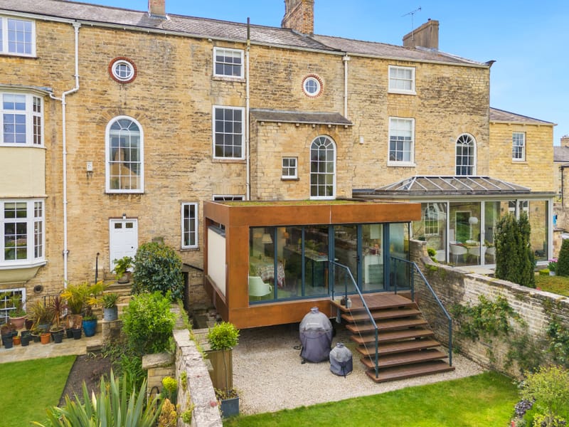
High-Resolution Aerial Photography
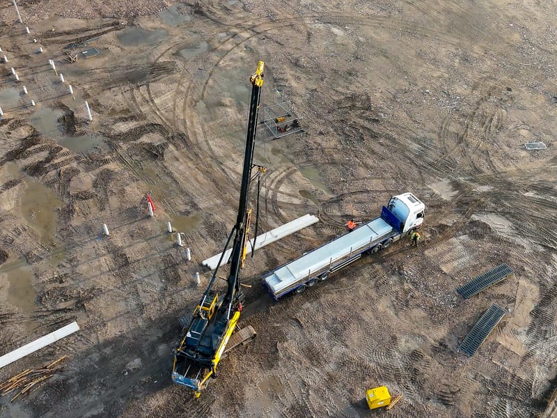
High-resolution aerial photography captures properties from above, highlighting setting, layout and surroundings with clarity and impact.
Learn More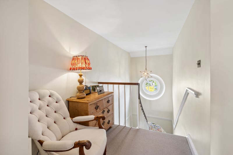
HDR Ground Photography
High-dynamic-range ground-level photography captures interiors and exteriors with balanced light, accurate colour and clear detail throughout.
Learn More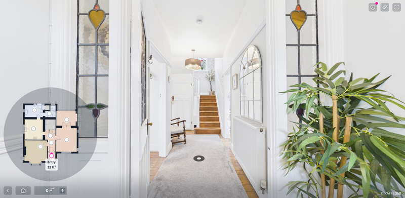
360 Virtual Tours
Immersive 360° virtual tours provide a clear, interactive way to showcase space, layout and surroundings, from interior property walkthroughs to live aerial 360° development tours that evolve as sites progress across Yorkshire.
Learn More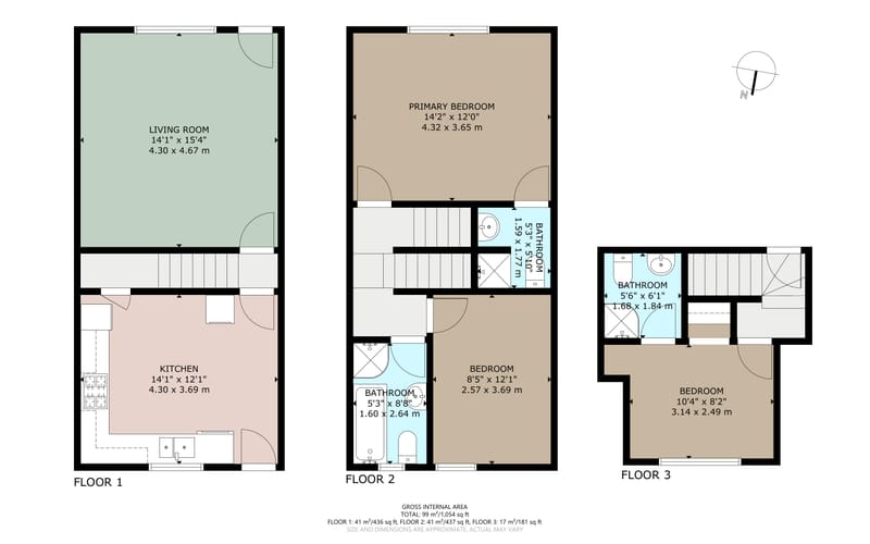
Floor Plans
Accurate, branded floor plan layouts with clear dimensions that showcase space and integrate seamlessly with photography and 360° virtual tours.
Learn More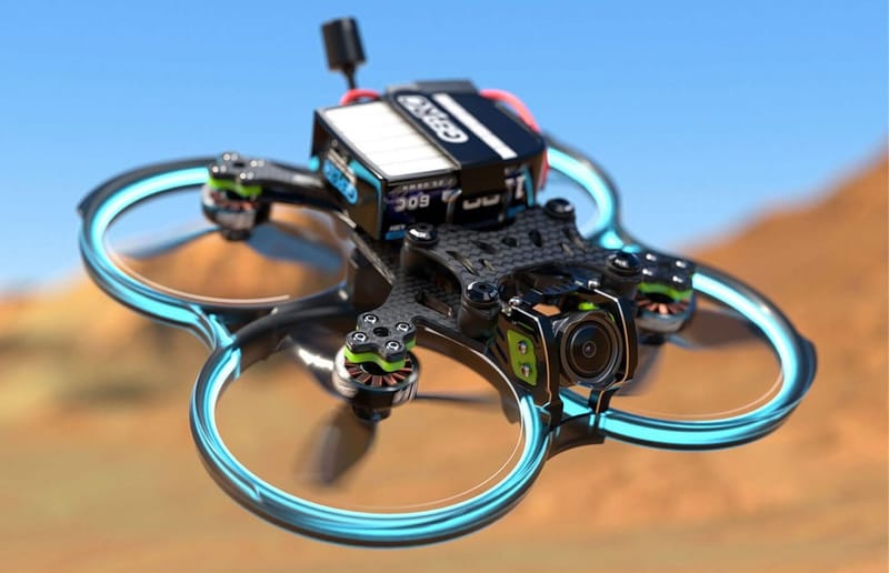
FPV Drone Fly-through
Dynamic first-person view drone tours capture fluid movement and perspective, creating engaging walkthrough-style experiences that showcase properties and spaces from every angle.
Learn More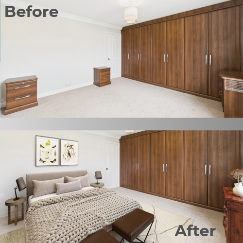
Virtual Staging
Virtual staging helps buyers instantly visualise space and potential by digitally furnishing vacant interiors, improving engagement on property portals and strengthening listing performance for empty homes, new builds and rental properties across Yorkshire.
Learn MoreLive Aerial 360° Development Tours
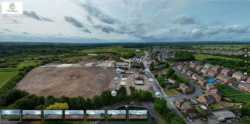
What Is a Live Aerial 360° Development Tour?
A Live Aerial 360° Tour is a cloud-hosted aerial walkthrough created from multiple drone-captured 360° viewpoints across a development site. Viewers can move between positions, look freely in all directions, and instantly understand site layout, surroundings and scale. The tour is updated during scheduled return visits, ensuring your marketing always reflects the current stage of development.
view a live aerial 360° tour case study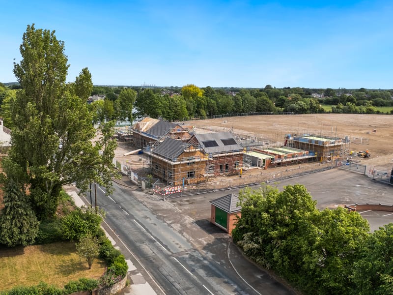
Why Housing Developers Use Live Aerial 360° Tours
Traditional drone photos and flyover videos quickly become outdated as a site progresses. Live Aerial 360° Tours provide a single interactive link that can be shared with stakeholders, sales teams and buyers, and updated throughout the build. This allows progress, layout and surroundings to be communicated clearly while reducing the need for frequent site visits.
How Live Aerial 360° Development Tours Work
Initial on-site drone capture to create the first live aerial 360° tour — Secure cloud hosting with a single shareable link — Scheduled update visits as the development progresses — New aerial 360° viewpoints added over time — Ongoing tour management handled by Skycraft UAV.

Pricing Structure for Live Aerial 360° Development Tours
Live Aerial 360° Tours are provided as an initial setup followed by an ongoing subscription for updates and hosting. This approach keeps costs predictable while ensuring the tour remains accurate as the development progresses. Pricing is based on site size, number of aerial viewpoints, update frequency and travel. A tailored quote is provided following a short discussion.

Discuss a Live Aerial 360° Tour for Your Development Site
If you’re looking for a clear, up-to-date way to present and track your development, get in touch to discuss Live Aerial 360° Tour setup options and update schedules
Request a QuoteLive Aerial 360° Development Tour: Active Site Case Study
This is a live development tour that updates automatically as the site progresses.
Interested in a live aerial 360° tour for your development?
Get in touch to discuss quarterly updates and hosting.
Drone & Virtual Tour Portfolio | Property Media by Skycraft UAV
Testimonials
Contact Skycraft UAV | Property Photography, Drone & 360° Tours in Yorkshire
- Wetherby, UK
- info@skycraftuav.co.uk
- Mon-Fri - 08:00-19:00
Get in touch with Skycraft UAV to arrange your next aerial or ground shoot, FPV fly-through, or 360° virtual tour. Based in Wetherby, we cover all of Yorkshire and beyond.